This setting allows you to display the location data as a separate map for each table record. You can set the width and height of the map in pixels.
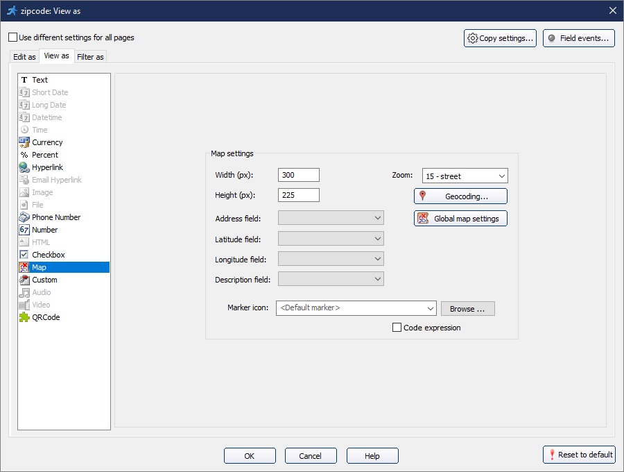
Use the address or latitude/longitude coordinates to set the location. It is highly recommended to use the Latitude and Longitude fields to make maps function properly.
The number given in the Zoom field will define the level of zoom on the map. Use the description field to set the descriptions for the markers.
Note: The address field accepts any widely-used address format (e.g. "1600 Amphitheatre Parkway, Mountain View, CA").
You may set a custom icon for map marker pins. Click Browse next to the Marker icon and select the icon image file.
You may also set different icons for different map objects by using the PHP expression option:
You may access Global map settings to select a map provider. Enter API Key (if required).
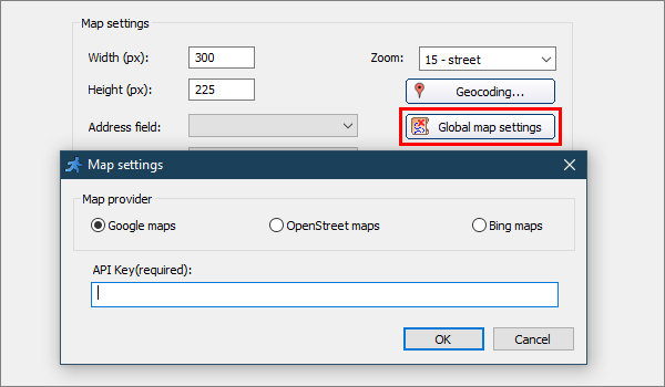
Note: you can get API keys for development purposes for free at https://developers.google.com (for Google maps) or at bingmapsportal.com (for Bing maps).
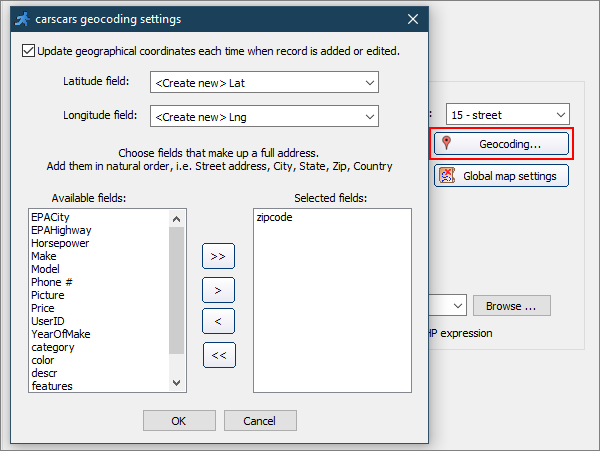
Use the Geocoding option to update the latitude/longitude information each time a record is added or updated.
Select existing fields for storing latitude and longitude data or create new ones. Then select address field(s) to be used during geocoding.
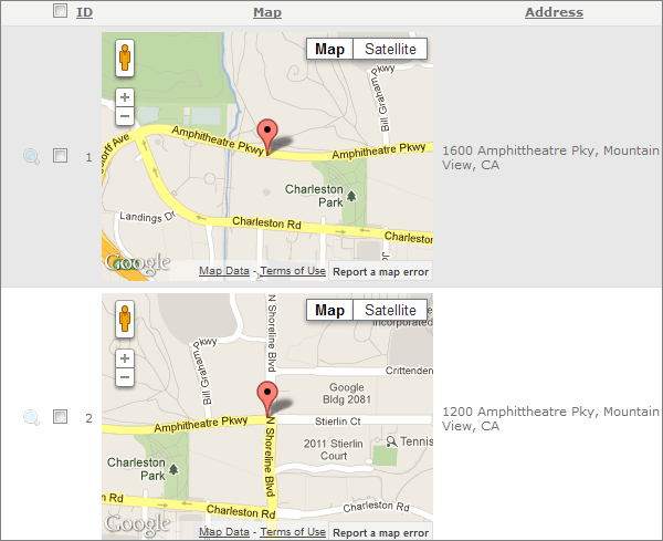
An example of how maps are displayed in a browser. Note that double left click will zoom in and double right click will zoom out.
Maps API providers have limits on the number of geocoding requests you can send per day, and also a limited requests rate.
For example, if you use Google Maps API and have a page with 20 records with a map for each one, only about 10 maps will be displayed properly. To overcome those limits you need to open a Premier account with Google that costs $10,000 per year.
The solution is to use latitude/longitude pairs instead of addresses for mapping purposes.
Enable the Geocoding option on the Choose pages screen to update latitude/longitude information each time when a record is added or updated.
The main question is how to convert the existing addresses to latitude/longitude pairs? The instruction is available at Insert Map - Geocoding.
See also:
•Miscellanneous settings: Map settings