Geocoding is the process of transforming a description of a location—such as a pair of coordinates, an address, or a name of a place—to a location on the earth's surface. You can geocode by entering one location description at a time or by providing many of them at once in a table.
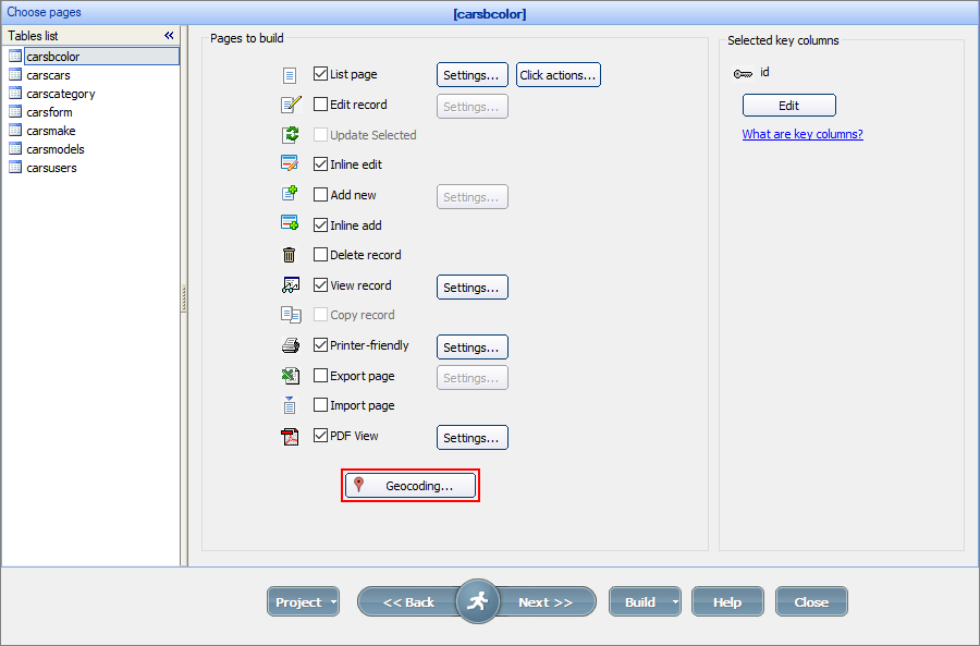
Geocoding is used for the tables where the location data is displayed as maps. To configure the Geocoding settings, click the corresponding button on the Choose pages screen.

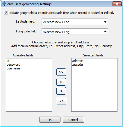
It is recommended to use the Latitude/Longitude fields to show coordinates on the map. The Geocoding function takes the address fields and automatically converts them into the Latitude/Longitude values each time the records are added or updated.
Note: most mapping/geocoding providers require you to specify their API key for this functionality to work. You can enter the key under Map settings on Miscellaneous screen.
Select the existing fields for storing latitude/longitude data or create new ones. Then select the address field(s) to be used during geocoding.

For more information about displaying data as maps, see Insert map.
How to geocode existing addresses in the database
If you need to convert a bunch of existing addresses to latitude/longitude values enable the geocoding first, then display as many records on the page as your can. Then select all and choose to Inline Edit all selected records. Click 'Save all' and wait till all records are saved. This is it.
How to geocode an address programmatically
If you need to convert an address to lat/lon pair manually in your code after, for instance, while adding a record manually, you can use CommonFunctions.getLatLngByAddr() fucntion.
dynamic location = CommonFunctions.getLatLngByAddr( "1600 Pennsylvania Avenue NW, Washington, DC 20500" );
MVCFunctions.Echo(location["lat"]);
MVCFunctions.Echo(location["lng"]);
See also:
•Using geolocation data in your web application